
Upper Mustang was closed to outside visitors until 1992, and it still feels like it: a high desert plateau behind the Annapurna range, culturally closer to Tibet than to the rest of Nepal, dotted with whitewashed monasteries, cave dwellings cut into cliff faces, and the walled former royal city of Lo Manthang. The Upper Mustang Trek is the single most visually distinct route we run.
In this article
Why it’s called the Forbidden Kingdom
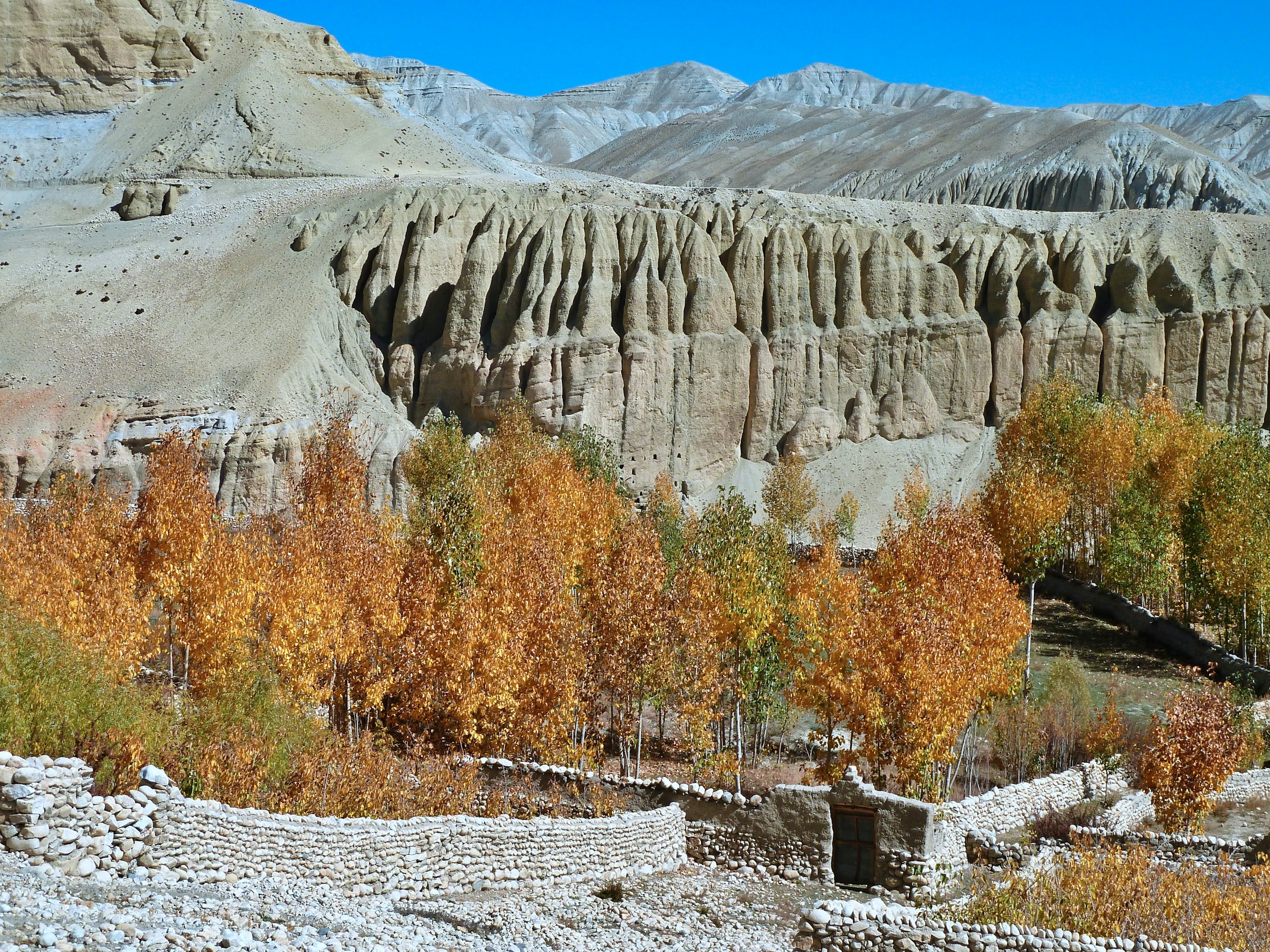
Mustang was an independent Tibetan Buddhist kingdom for centuries, and its remoteness behind the Annapurna range kept it largely sealed off even after the rest of Nepal opened to trekkers. That isolation preserved a culture, architecture and landscape found almost nowhere else on a standard trekking itinerary: red cliffs, eroded canyons, and villages built around chortens and monasteries rather than teahouses built for tourism. Lo Manthang itself, the walled former capital, still has a royal palace and several centuries-old gompas with wall paintings that are among the finest surviving examples of Tibetan Buddhist art anywhere.
The route
Our itinerary runs 16 days from Kathmandu. You take the tourist bus to Pokhara, fly the short hop up the Kali Gandaki to Jomsom, and drive to Kagbeni, the gateway to Upper Mustang, where restricted-area permits are checked. A jeep road now runs most of the way north, and we use it where the walking adds little, then put you on foot for the parts worth walking: the Chungsi cave monastery above Samar, the climb to Syangboche, and the trail past Ghar Gompa, one of the oldest monasteries in the region, to Charang. After two nights in Lo Manthang the route comes back down the quieter eastern side of the valley through Dhi, Yara, the cliff-top Luri Gompa, Tangye and Tetang to Muktinath, and that return is where most of the real trekking happens. From Muktinath you drive to Jomsom and fly back to Pokhara, with a spare day built in for weather. Because the terrain sits in Annapurna’s rain shadow, it’s dry and windy rather than wet.
What you’ll actually see in Lo Manthang
The walled city holds several major monasteries, including Thubchen and Chode, a royal palace still associated with the former royal family, and narrow lanes that have barely changed in centuries. Guided visits to the monasteries, where permitted, reveal wall paintings and statues that are actively conserved rather than museum pieces behind glass. The surrounding caves, cut into the cliffs of the valley, are thought to be centuries old and some are still used for storage or religious purposes by local communities.
Permits
Like Manaslu, Upper Mustang is a restricted area requiring its own permit on top of the standard conservation area fee, priced per ten-day block. It is issued through a registered agency to travellers walking with a licensed guide, and since March 2026 that includes solo travellers, so you no longer need a second trekker on the permit. We handle the full application and it’s included in the trip price. See our permits guide for how the standard fees work alongside it, and get in touch early since restricted-area permits for this region need more lead time than a standard application.
Cost
The price is per person: 2,270 USD for a solo traveller, 1,890 USD each for two or three travellers, 1,775 USD each for four to six, and 1,665 USD each for seven or more. The price reflects the restricted-area permit and the Jomsom flights, and it also covers the Kathmandu and Pokhara hotels, the tourist bus, jeep transfers and a farewell dinner in Pokhara. Full details and the group-size ladder are on the Upper Mustang Trek page.
Difficulty
We grade this moderate. You sleep between about 2,800 and 3,800 metres, lower than the big passes elsewhere, and the highest point is the Dhi pass at around 4,100 metres. The return along the eastern side has long days, including an eight to nine hour stretch from Tangye to Tetang with no villages in between, and the wind and dust can be demanding in their own way, particularly in the afternoons when valley winds pick up. For how this compares with other routes, see our guide to Nepal trekking difficulty levels.
Best time to go
Because Mustang sits in a rain shadow, it’s one of the few routes that’s genuinely trekkable through the monsoon months of June to August, when most other treks in Nepal are difficult or need rerouting. Autumn and spring remain the most comfortable windows for temperature. If your travel dates are fixed to the monsoon, this is one of the best options on our books, though the Jomsom flights can still be delayed by cloud, which is why the itinerary has a spare day and a drive-out backup.
Packing notes specific to Mustang
Dust and wind are the defining conditions here rather than cold or wet weather. A buff or scarf for your face, good sunglasses, and lip balm matter more on this route than on most of our others, alongside the usual layering system for the big day-to-night temperature swings typical of high desert terrain. Bring sandals too, as the Yara to Tangye day usually involves wading a river with no bridge.
Booking
Every trek is private and scheduled around your dates, not a fixed departure calendar. Read how booking works, or contact us with your dates so we can start the restricted-area paperwork, which needs more lead time than a standard permit.