Tilicho Lake and Thorong La Trek
- Duration
- 17 days
- Max altitude
- 5,416 m
- Difficulty
-
Very strenuous
Difficulty scale
- Easy Short walking days on good trails below about 3,000 m. Suitable for anyone in ordinary health, including families.
- Moderate 5 to 6 hours a day with some steep sections, reaching up to about 4,000 m. A reasonable level of fitness and a few weeks of preparation walking recommended.
- Strenuous 6 to 8 hours a day, high passes or altitudes above 5,000 m, and remote stretches. Good fitness, prior trekking experience and proper acclimatisation days are essential.
- Very strenuous Long days, multiple high passes or technical sections, sustained time above 5,000 m. For experienced, well-conditioned trekkers only.
- Best season
- Autumn (Sep–Nov) · Spring (Mar–May)
- Group
- Private
- From
- $1,135.00
Overview
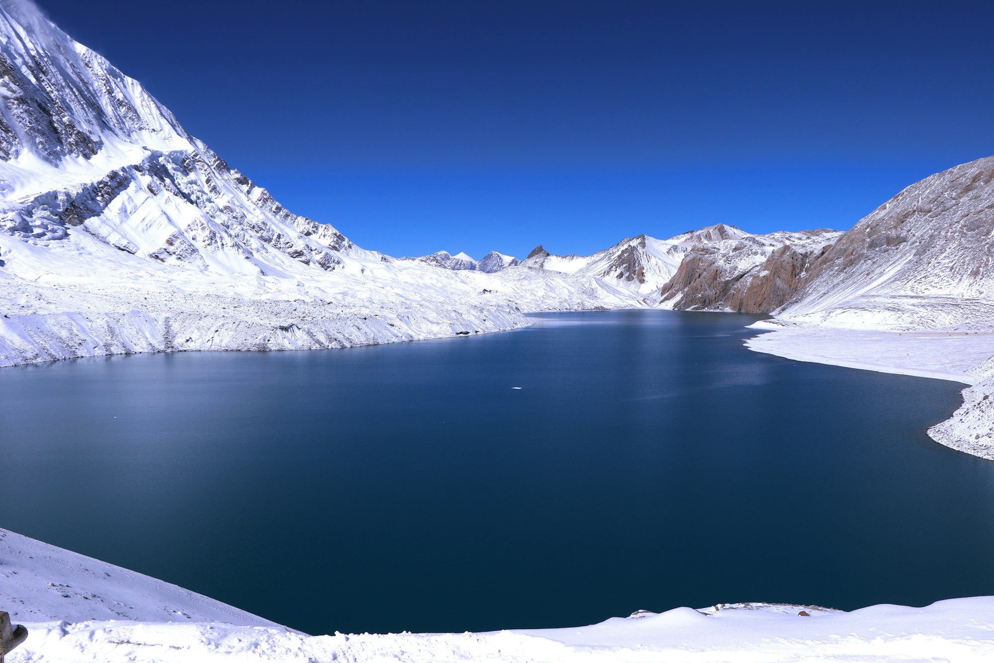
The Annapurna circuit with Tilicho Lake added, one of the highest lakes of its size anywhere at 4,919 m. The approach traverses a notoriously loose slope, so it is a route for people who are steady on their feet.
Every departure is private and led by a government-licensed Nepali guide, so the plan flexes to your party and to the mountain. Permits, park fees and local taxes are inside the price you see.
Trip highlights
- Tilicho Lake at 4,919 m
- Thorong La at 5,416 m
- The full Annapurna circuit as well
- A demanding traverse on the lake approach
Day by day
The itinerary
-
Day 1: Arrive in Kathmandu (1,400 m) 1,400 m Hotel
Our representative meets you at Tribhuvan International Airport and transfers you to the hotel, followed by the trek briefing and a kit check.
-
Day 2: Drive to Besisahar (760 m) 760 m 6-7 hrs Hotel B
West along the Prithvi highway beside the Trishuli, then north at Dumre into the Marsyangdi valley. Besisahar is the old starting point for the Annapurna Circuit and still the place where the tarmac ends and the jeeps take over.
-
Day 3: Jeep to Dharapani (1,860 m) 1,860 m 4-5 hrs Teahouse B/L/D
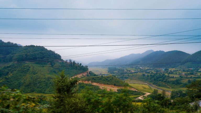
A rough shared-jeep day up the valley on a road cut into the gorge wall, through Bhulbhule, Jagat and Tal. Spectacular and uncomfortable in roughly equal measure. The road has pushed a long way up this valley in recent years, which removes several hot low-altitude walking days that used to be the dullest part of the circuit.
-
Day 4: Dharapani to Chame (2,670 m) 2,670 m 5-6 hrs Teahouse B/L/D
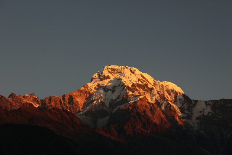
Up through pine and fir with Annapurna II showing itself on the right. Past Danaque and Timang, where the view opens properly, to Chame, the district headquarters of Manang, which has small hot springs by the river.
-
Day 5: Chame to Upper Pisang (3,300 m) 3,300 m 5-6 hrs Teahouse B/L/D
Through a narrow steep-walled section of valley and past the great curved rock face of Paungda Danda, which rises well over a thousand metres straight out of the river. We take the upper route to Upper Pisang, which is the harder option and much the better one.
-
Day 6: Upper Pisang to Manang (3,540 m) via Ghyaru and Ngawal 3,540 m 6-7 hrs Teahouse B/L/D
The high route, again by choice. It climbs hard out of Pisang to the old fortified villages of Ghyaru and Ngawal, which sit on a shelf facing the entire Annapurna wall across the valley. Better acclimatisation and a far better day than the valley floor alternative.
-
Day 7: Manang: acclimatisation day 4,000 m 4-5 hrs Teahouse B/L/D
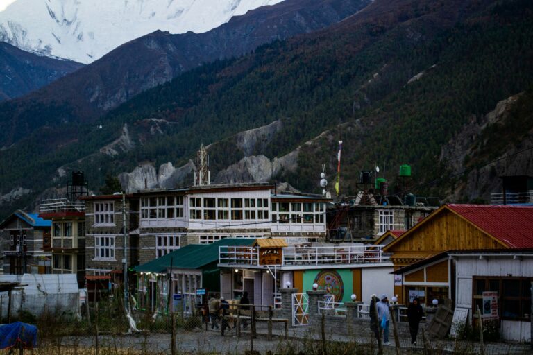
A day held at Manang. We walk up towards the Gangapurna viewpoint and the glacial lake below the icefall, to about 4,000 m, then come back down to sleep. The Himalayan Rescue Association runs a free altitude talk here most afternoons in season and it is worth an hour of anyone's time.
-
Day 8: Manang to Shree Kharka (4,050 m) 4,050 m 4-5 hrs Teahouse B/L/D
Leave the main circuit here. The trail turns west through Khangsar, the last village, and climbs onto a dry shelf above the Khangsar Khola. Far fewer people on this side, and the landscape turns to bare rock and scrub.
-
Day 9: Shree Kharka to Tilicho Base Camp (4,150 m) 4,150 m 4-5 hrs Teahouse B/L/D
A short day in distance with a serious piece of ground in the middle: a long traverse across loose eroding scree slopes where the path is rebuilt most seasons. Straightforward in good conditions, unpleasant in bad, and done early before the afternoon.
-
Day 10: Tilicho Lake (4,919 m), return to Shree Kharka (4,050 m) 4,919 m 7-8 hrs Teahouse B/L/D
A pre-dawn start for the long zigzag climb to the lake, one of the highest of its size anywhere in the world, held in a basin under Tilicho Peak with the Grande Barriere behind it. It is frozen for much of the year and an unreal blue when it is not. Back down to base camp and on to Shree Kharka to sleep lower.
-
Day 11: Shree Kharka to Yak Kharka (4,050 m) 4,050 m 5-6 hrs Teahouse B/L/D
Rejoin the circuit, cutting across rather than dropping all the way back to Manang. Open grazing country with blue sheep on the slopes and the first sense of the pass ahead.
-
Day 12: Yak Kharka to Thorong Phedi (4,525 m) 4,525 m 3-4 hrs Teahouse B/L/D
A deliberately short day. Up the valley past Ledar on a narrowing trail with a slide-prone section before the bridge. Thorong Phedi means the foot of Thorong, and it exists only to stage tomorrow. An early dinner and an earlier night.
-
Day 13: Thorong La (5,416 m) and down to Muktinath (3,760 m) 5,416 m 8-9 hrs Teahouse B/L/D
The big day, starting in the dark to be over the pass before the wind gets up. A relentless climb of false summits to the prayer flags and the sign at the top, then a very long descent, over 1,600 m of it, into the Mustang side. Muktinath at the bottom is sacred to Hindus and Buddhists both, with its 108 water spouts and the flame burning beside the spring.
-
Day 14: Muktinath to Jomsom (2,720 m) 2,720 m 5-6 hrs Teahouse B/L/D
Time at the temple first, before the crowds arrive by jeep. Then down through the high desert past Jharkot and Kagbeni into the Kali Gandaki, walking into the famous afternoon wind for the last stretch to Jomsom.
-
Day 15: Fly to Pokhara (820 m) 820 m Hotel B
An early flight down the gorge between Dhaulagiri and Annapurna, twenty of the most spectacular minutes in Nepali aviation. It goes early because of the wind. Afternoon free on the lakeside, which after two weeks on the trail is exactly the right place to be.
-
Day 16: Return to Kathmandu (1,400 m) 1,400 m 6-7 by road hrs Hotel B
Back by tourist coach along the Trishuli, six to seven hours, or by the 25-minute flight at extra cost. Evening free.
-
Day 17: Departure 1,400 m B
Our representative takes you to the airport about 3 hours before your onward flight.
Altitude profile
The climb, day by day
Comfort tiers
Choose your level of comfort
| Amenity | Standardfrom $1,360.00 | Comfortfrom $1,604.80 | Luxuryfrom $1,972.00 |
|---|---|---|---|
| Kathmandu hotel | 3★ | 4★ | 5★ |
| Trail accommodation | Standard teahouse | Best lodge in each village | Premium lodge where the route has one |
| Porter support | Shared porter | Private porter, lighter load | Extra porter, carry almost nothing |
| Transfers | Shared | Private | Private, throughout |
What's included
Included
- Included: Two nights in Kathmandu, one in Besisahar and one in Pokhara, in hotels on a twin-sharing bed and breakfast basis
- Included: Twin-sharing teahouse accommodation on the trek
- Included: Three meals a day on the trek, breakfast, lunch and dinner
- Included: International and domestic airport transfers
- Included: Kathmandu to Besisahar by private vehicle
- Included: Shared jeep from Besisahar to Dharapani
- Included: Jomsom to Pokhara flight
- Included: Pokhara to Kathmandu by tourist coach
- Included: Annapurna Conservation Area Permit (ACAP)
- Included: TIMS card
- Included: A professional, government-licensed, English-speaking trekking guide
- Included: Porters to carry your luggage, one porter for every two trekkers
- Included: Sleeping bag and duffel bag for the trek, returned afterwards
- Included: First aid kit
- Included: All administrative expenses and government taxes
Not included
- Not included: International airfare and the Nepal entry visa
- Not included: Travel insurance covering helicopter evacuation to at least 5,500 m
- Not included: Lunch and dinner in Kathmandu, Besisahar and Pokhara
- Not included: Bottled water, soft drinks and alcohol
- Not included: Hot showers, battery charging and wifi at the lodges
- Not included: Personal trekking clothing and equipment
- Not included: The Pokhara to Kathmandu flight instead of the coach, if you prefer it
- Not included: Tips for the guide, porters and drivers
- Not included: Extra costs caused by weather, flight delays, landslides, illness, early departure or any other event beyond our control
- Not included: Anything not listed under what is included
Your team
Led by a licensed guide
Every route is led by a government-licensed guide from our team. Licences are on record with us before departure, and you'll meet your guide once your trip is confirmed.
Guide language(s): English, Nepali
Group-size pricing
Walk together, pay less
Every trip is private, so the guide, permits and transfers cost the same however many walk. Sharing them is why the per-person price falls: arithmetic, not a sale.
| Group size | per person | You save each |
|---|---|---|
| 1 traveller | $1,360.00 | base rate |
| 2 to 3 travellers | $1,135.00 | $225.00 |
| 4 to 6 travellers | $1,065.00 | $295.00 |
| 7 or more | $1,000.00 | $360.00 |
Per person, including permits, park fees and taxes. Nothing is added at checkout.
Weather
What to expect, month by month
- Autumn (Sep–Nov)The most reliable trekking season: clear air, stable weather and cold nights, right after the monsoon clears.
- Spring (Mar–May)Warmer than autumn, with rhododendron forests in flower and slightly hazier mountain views as the season goes on.
Traveller reviews
What travellers say
Why book with us